There is a lot of talk about Pollinator Highway but what exactly is it, where it is located and what is its purpose?
Pollinator Highway is a collective term for urban planning related activities stretching from Kopli freight station all the way to Hiiu along an old railway line. The result of these interventions is a green and light traffic axis connecting six districts of Tallinn, which sees to the needs of the residents as well as the natural environment. Pollinator Highway as a concept has acquired a life of its own, which at times, it seems, has outgrown the project and may no longer be tied to any specific location. The connection between the new linear park and actual global concerns, along with the need to solve those at local level, such as through sustaining biodiversity in urban environments, has reached the hearts of many.
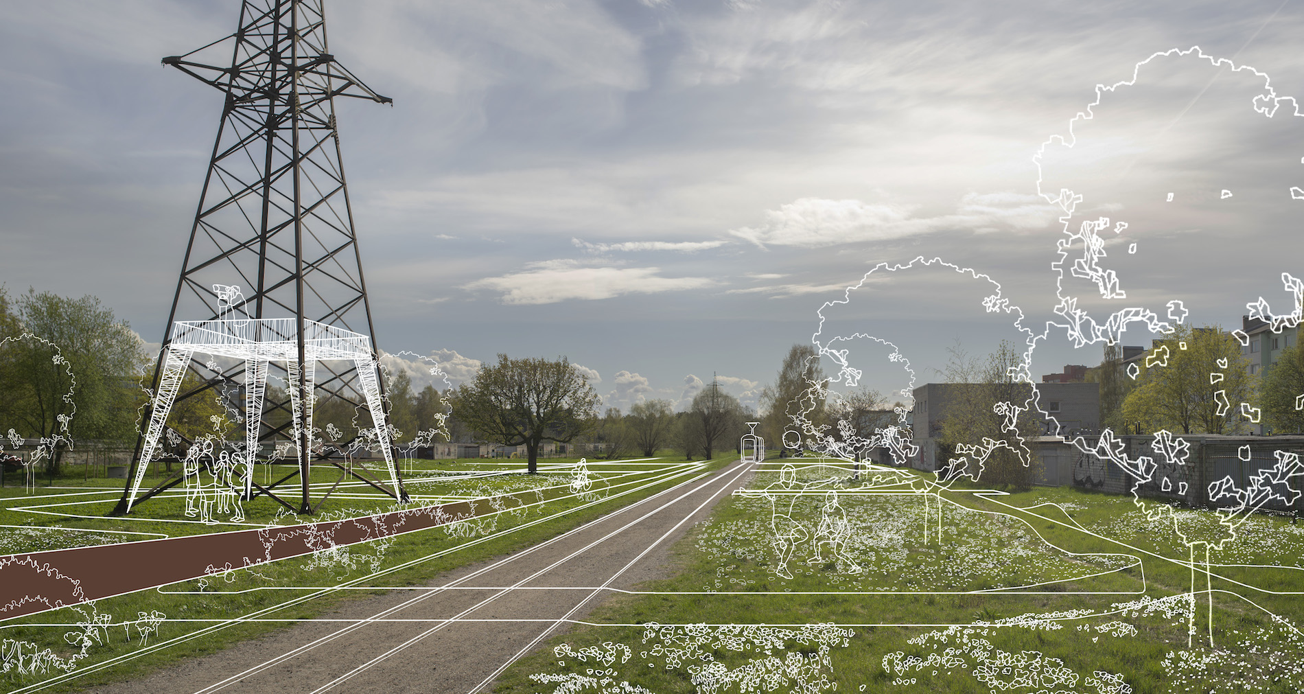
The concept behind the typology of the new green corridor was conceived at a brainstorming event in 2019 at the Urban Planning Department of Tallinn. One of the incentives behind the work performed in the framework of the external project ‘Augmented Urbans’ was a conclusion drawn from an environmental study which stated that the land underneath high-voltage power lines is a significant axis for the path of insect pollinators reaching from Astangu to the core of the city. Meadows well adapted to the needs of pollinators had evolved due to safety requirements that had been restrictive of human activity. Another incentive was Elering’s plan to transfer the power lines underground, leaving the land free for re-conceptualisation.
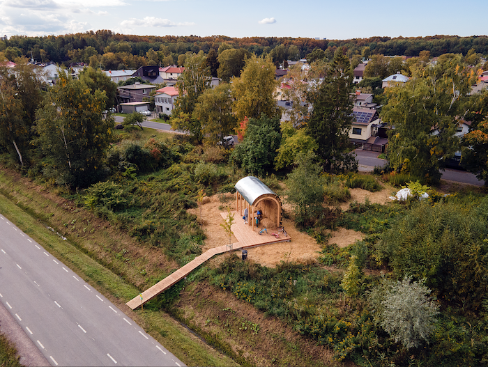
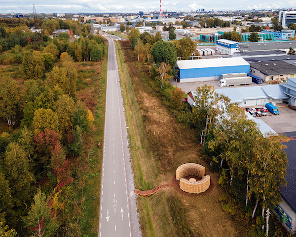
The 13-kilometre-long linear park traversing West-Tallinn differentiates between nine urban space typologies. Pollinator Highway passes through areas of private housing and apartment buildings, industrial areas and wastelands, as well as existing parks and forests. In different areas, the planned Pollinator Highway takes on different shapes and forms. Restricted areas will be plugged into the green and pedestrian network. More developed areas with functioning parks or green areas will be made more accessible. In regions such as Merimetsa with an already considerable load bear, the goal is to organise and, at times, decrease the effects of human activity by enabling certain animal species to use the quieter areas of the park. The extent of intervention is dependent on absolute minimal requirement in the given region, minding the forecasted effects on biodiversity.
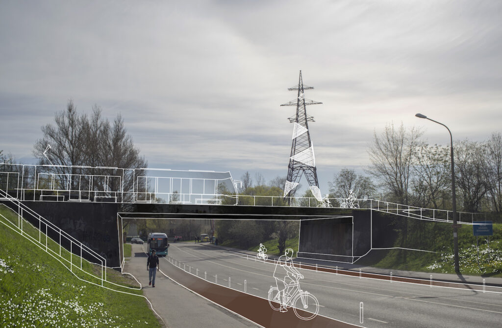
In general, the Pollinator Highway line can be divided into two parts: from Telliskivi Street to Paldiski Road, and from there to Hiiu railway stop. The portion of the Pollinator Highway in North-Tallinn is comprised of a variety of areas that until recently have been closed to the public, such as the area of the Kopli freight station, or with restricted access, such as the high voltage power line territory around Sõle Street. The nature of the development of these spaces in particular will be the most drastic, resulting in spaces previously known as transitory areas being turned into primary targets or high-quality environments desirable for the daily use of citizens.
While in North-Tallinn, Pollinator Highway traverses a rich versatile urban space, other districts face the challenge of the mental and physical distance between the city and the linear park. The existing light traffic road has been established as an infrastructural unit that only carries the function of enabling linear movement while, unfortunately, not being too good at that either. Mutual restriction of differing mobility speeds, lack of contact area, and spatial monotony are the primary negative attributes. The goal of functions added in the framework of the Pollinator Highway project, such as dividing and distinguishing mobility speeds and typologies, enforcing local needs and connections, and supporting green components, are to foster an infrastructurally conceptualised object into a park.
The Pollinator Highway project has a direct influence on the surrounding cityscape: for example, the former Kopli freight station and the future decisions regarding the Paavli district will be largely influenced by the new pathways and tram stops, which will be connecting current backyard areas with the public space network. Pollinator Highway works on various scales, depending on the direction: lengthwise, it is part of the network of green corridors functioning across city borders, while crosswise, it acts as a magnifier of local potentialities and as an influencer of development trends.
PACO ULMAN Is an architect at Tallinn Strategic Management Office as well as a doctoral student and a teacher at Estonian Academy of Arts.
HEADER: View of Paavli and Pelguranna park section. Tallinn Spatial Design Department, 2022.
PUBLISHED: Maja 111 (winter 2023) with main topic Street Unrest